
Arctic Sea Ice Cover Trends
As assessed over the period of satellite observations, October 1978 to present, there are downward linear trends in Arctic sea ice extent for all months, largest at the end of the melt season in September. The ice cover is also thinning. Downward trends in extent and thickness have been accompanied by pronounced interannual and multiyear variability, forced by both the atmosphere and ocean. As the ice thins, its response to atmospheric and oceanic forcing may be changing.
In support of a busier Arctic, there is a growing need to predict ice conditions on a variety of time and space scales. A major challenge to providing seasonal scale predictions is the 7-10 days limit of numerical weather prediction. While a seasonally ice‐free Arctic Ocean is likely well within this century, there is much uncertainty in the timing. This reflects differences in climate model structure, the unknown evolution of anthropogenic forcing, and natural climate variability.
In sharp contrast to the Arctic, Antarctic sea ice extent (extent in this context as meaning the measurement of area), while highly variable, has increased slightly over the period of satellite observations. The reasons for this different behaviour remain to be resolved, but responses to changing atmospheric circulation patterns appear to play a strong role.
Using Satellites and Data Analysis
The Arctic is in the midst of rapid change in its physical environment with pronounced increases in surface air temperature, especially for winter and spring over subarctic land areas (Serreze and Francis 2006; Screen et al. 2012), as well as over the Arctic Ocean (e.g. Comiso 2003; Kohnemann et al. 2017).
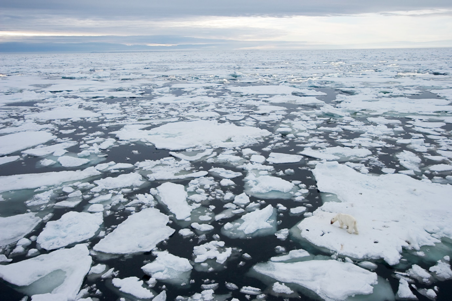
Arctic sea ice extent has declined throughout the satellite era, with the record September minimum extent in 2012 (Fig. 1) and the smallest maximum extent in March 2017 (National Snow and Ice Data Center 2017). Sea ice cover has thinned dramatically (Kwok and Untersteiner 2011), as historical evidence suggests that the recent sea ice minima are unmatched across the Arctic back to 1850 (Walsh et al. 2017). Spring snow-cover extents (SCE) over Eurasia and North America have significantly declined since 2005 (National Oceanic and Atmospheric Administration 2016), with Arctic SCE declining more rapidly than September minimum sea ice extent (e.g. approximately −18% for June over the period 1967-2016; Derksen et al. 2017).
Subsurface warming of the permafrost has also been observed in borehole measurements (e.g. Romanovsky et al. 2010). The area of the Greenland Ice Sheet experiencing summer melt has increased, and in mid-July 2012 some 99% of the surface area was melting according to satellite observations, a highly unusual but not unique event (Nghiem et al. 2012). There has also been accelerated movement of Greenland outlet glaciers and increased runoff to the ocean (e.g. Rignot et al. 2011) as Greenland remains the largest land ice mass contributor to sea level rise (Harig and Simons 2016). However, glacier loss in other areas such as the Gulf of Alaska and the Canadian Archipelago are also significant contributors to sea level rise (Harig and Simons 2016) and may not be recoverable this century (Lenaerts et al. 2013).
The symptoms of accelerated Arctic climate change are seemingly pervasive (Intergovernmental Panel on Climate Change 2013).
While this video is not the clearest, a presentation on the Arctic Climate Emergency at the Madrid COP 25 conference in December 2019, issues a dire warning for the future of the Arctic.
Current Arctic Sea Ice Extent
Arctic sea ice extent for February 2020 was 14.68 million square kilometres (5.67 million square miles), the thirteenth lowest in the satellite record. This was 620,000 square kilometres (239,000 square miles) below the 1981 to 2010 February average and 710,000 square kilometres (274,000 square miles) above the record low mark for February set in 2018. At the end of February, ice extent was below average over parts of the Barents and Kara Seas, and the eastern Greenland Sea.

Arctic sea ice extent for February 2020 was 14.68 million square kilometres (5.67 million square miles). The magenta line shows the 1981 to 2010 average extent for that month.
Copyright © All Rights Reserved
